
HISTORY & GALLARY
History of GiT4NHDM: International Conference on Geoinformation Technologies for Natural Hazards and Disaster Management
A Global Platform for Geospatial Innovation and Disaster Resilience
Since its establishment in 2007, the Geoinformation Technologies for Natural Hazards and Disaster Management (GiT4NHDM) conference has evolved into an international platform for advancing geospatial technologies, interdisciplinary research, and innovative solutions for natural hazards, disaster risk reduction, and resilience. Originally known as GiT4NDM, the conference was established to bring together researchers, academics, professionals, policymakers, and technology innovators to explore how geoinformation technologies can support disaster preparedness, response, recovery, and sustainable development.
Since 2007, GiT4NHDM has connected experts and institutions across Asia, the Middle East, Europe, and North America, fostering international collaboration and knowledge exchange. Through its conferences, workshops, and related activities, the initiative has continued to promote integrating geospatial information, remote sensing, geographic information systems (GIS), artificial intelligence (AI), GPT, cognitive and Agentic GeoAI, and other emerging technologies into natural hazard assessment and disaster management.
A Journey of International Collaboration
Since its inception, GiT4NHDM has progressed through a series of international events, reflecting its growing geographical reach and evolving scientific and technological priorities.
-
2007 – Iran: The inaugural conference was held in Iran, attracting more than 700 participants and establishing a strong foundation for international dialogue on geoinformation technologies and disaster management.
-
2009 – Bangkok, Thailand: The conference continued its international journey in Bangkok, welcoming more than 350 participants and strengthening regional and international engagement.
-
2011 – Chiang Mai, Thailand: The event continued in Chiang Mai, further extending the conference’s reach within the international geospatial and disaster management community.
-
2012 – Sri Lanka: The initiative expanded its geographical presence with an event in Sri Lanka.
-
2013 – Canada: The conference continued its international expansion in Canada with 100 participants, broadening opportunities for cross-continental collaboration.
-
2015 – Al Ain, United Arab Emirates: The event attracted more than 580 participants, demonstrating growing interest in the application of geoinformation technologies to natural hazards and disaster risk management.
-
2017 – Malaysia: The conference continued to strengthen regional partnerships and promote knowledge exchange among researchers and practitioners.
-
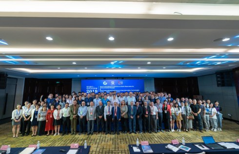
2019 – Chengdu, China: With more than 370 participants, the event further reinforced the conference’s international profile and its role in connecting geospatial research with disaster management practice.
-
2021 – Malaysia: The initiative continued in Malaysia with more than 270 participants, sustaining international engagement amid significant global challenges.
-
2023 – International Workshop Series: The conference evolved into an international workshop series, providing additional opportunities for focused discussions, collaboration, and knowledge dissemination.
-
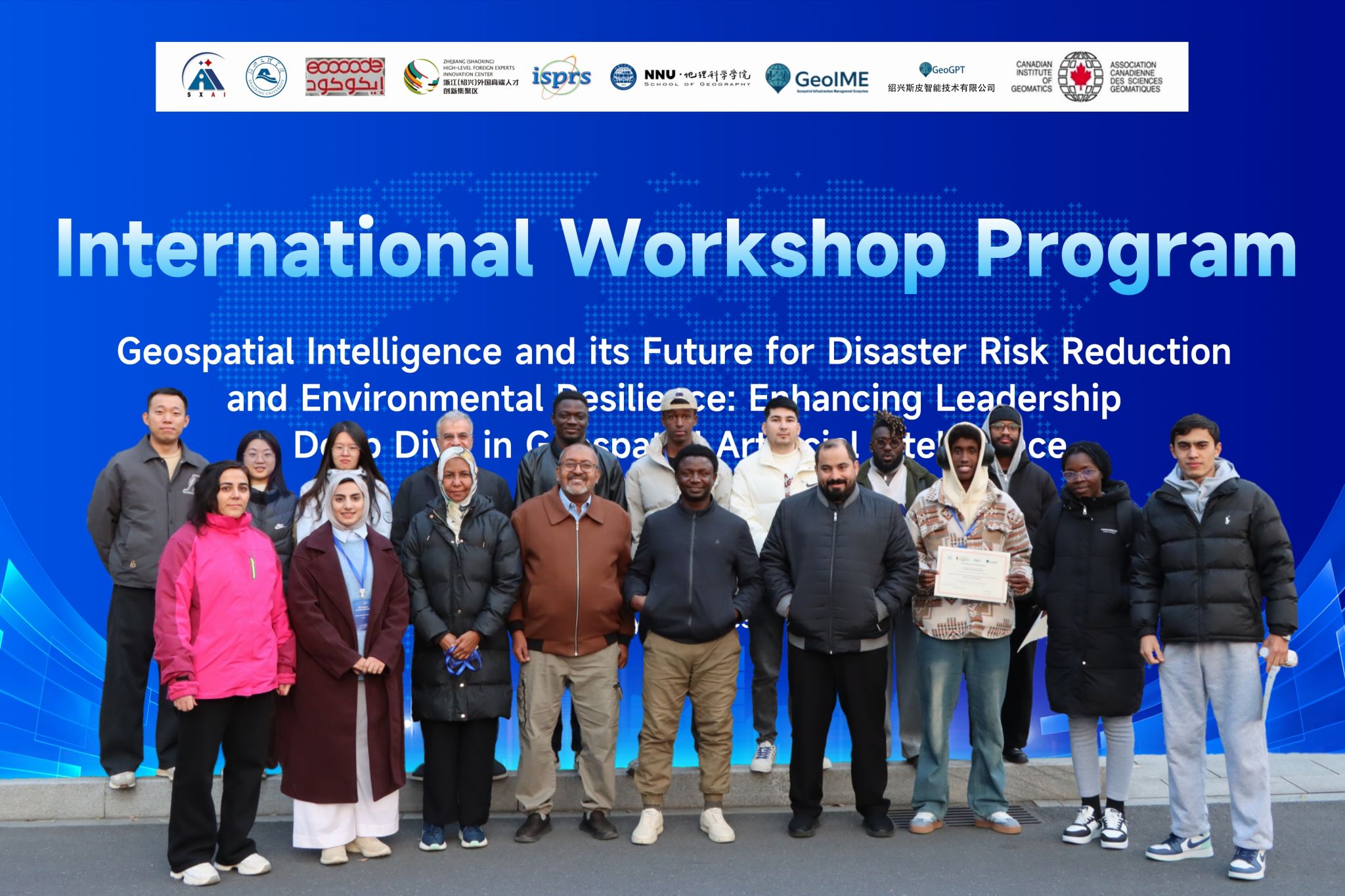
December 2025 – International Workshop: GiT4NHDM organized a workshop as part of its ongoing effort to sustain the initiative, strengthen its collaborative network, and prepare for its next phase of development, with 48 participants around the world.
-
2026 – Shaoxing, China: The next planned milestone is the international GiT4NHDM event in Shaoxing, Zhejiang Province, China. Building on nearly two decades of international engagement, the 2026 event aims to strengthen global partnerships and explore emerging opportunities in geospatial intelligence, AI-enabled disaster management, and resilient and sustainable development.
Collectively, these milestones reflect the conference’s continuing commitment to connecting scientific innovation with practical solutions for natural hazards and disaster risk management.
Explore the conference history and event gallery: https://www.jarpartner.com/?page_id=7235
GiT4NHDM 2026: Shaoxing, China
The 2026 GiT4NHDM event in Shaoxing represents an important opportunity to renew and expand the conference’s international network. It will bring together researchers, academics, engineers, government representatives, industry professionals, and other stakeholders to exchange knowledge, share advances, and develop collaborative approaches to pressing global challenges.
Shaoxing University, International Keqiao Park, and Bayanat Geographical Consulting (Oman) will collaborate to organize the event, with Bayanat Geographical Consulting (Oman) serving as the main organizer. It will also benefit from the participation and support of international and national institutions, scientific organizations, universities, research laboratories, and industry partners.
Participating organizations and knowledge partners include:
-
Zhejiang Yiyue Technology Co., Ltd., China
-
ISPRS ICWG III/IVa – Disaster Management
-
Canadian Institute of Geomatics (CIG), Canada
-
IEEE Geoscience and Remote Sensing Society (IEEE GRSS/GSEO) – Disaster Management and Early Warning
-
Zhejiang–Saudi Arabia Joint Laboratory
-
University of South Africa (UNISA)
-
Yarmouk University, Jordan
-
United Nations Global Geospatial Knowledge and Innovation Centre
-
Institution of Engineering and Technology (IET), China
-
University Continentale, Gabon
-
Asian Academy of Sciences
-
GeoGPT Shaoxing Ltd., China
-
GeoIME Inc., Canada
Through this collaborative network, GiT4NHDM seeks to strengthen the links between scientific research, technological development, education, policy, and practical applications. Key opportunities include advancing geospatial AI, Earth observation, disaster intelligence, risk assessment, early warning, and decision-support systems to build more resilient communities.
Looking Ahead: Building a More Resilient Future
For the 2026 event, organizers anticipate participation from at least 15 countries, with more than 100 participants. The gathering will provide an international forum to exchange ideas, present research, develop partnerships, and identify new opportunities for cooperation among academia, industry, government, and international organizations.
As natural hazards and disaster risks become increasingly complex, the need for reliable geospatial information, advanced analytical capabilities, and coordinated international action continues to grow. GiT4NHDM remains committed to supporting this effort by bringing people, knowledge, and technology together to advance disaster risk reduction and sustainable development.
From its 2007 beginnings to its planned gathering in Shaoxing in 2026, GiT4NHDM continues to bridge geospatial innovation and real-world disaster management—working toward a safer, smarter, and more resilient world.
More coming..
GeoIME Pitch Video:
GeoIME Brochure
Chengdu, China (GiT4NDM 2019)